Circumnavigating Siwash Rock
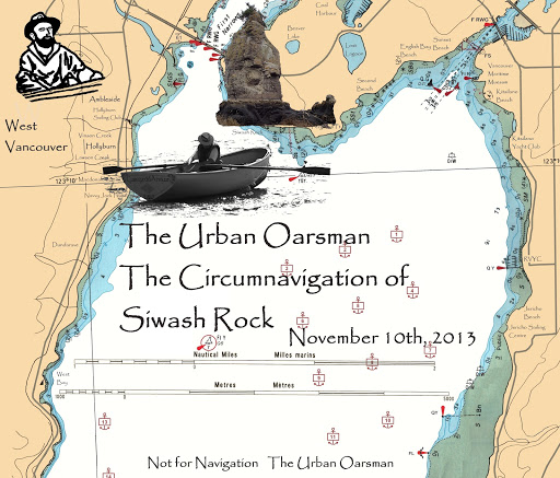
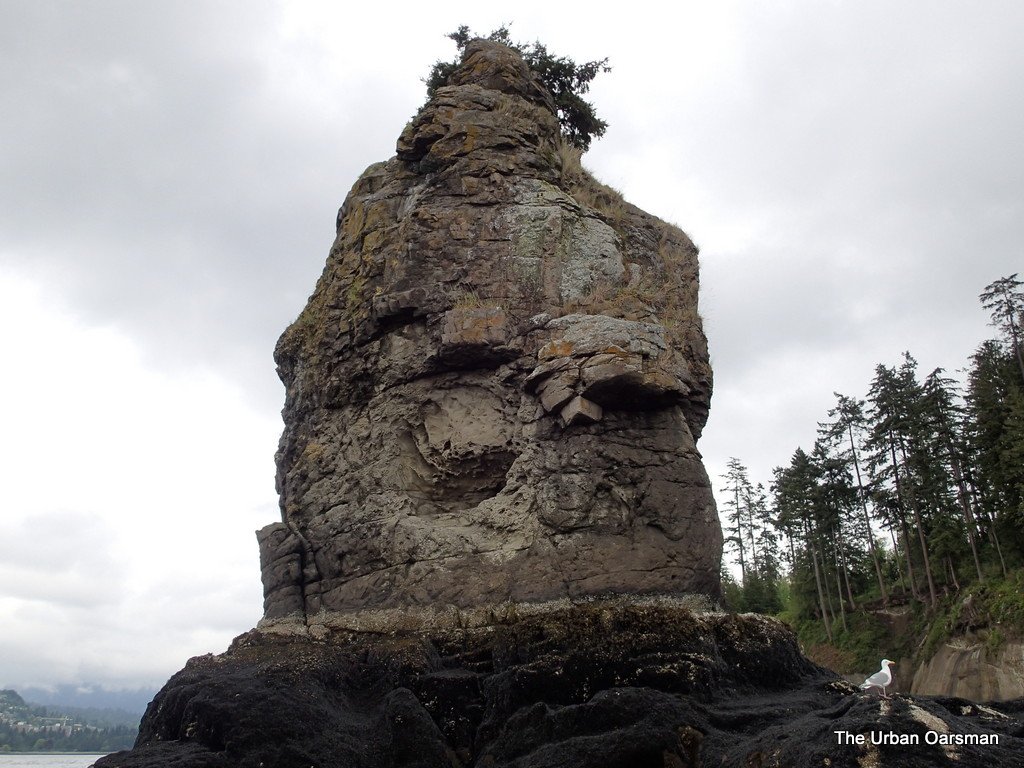
One of the most recognised land features in Stanley Park is Siwash Rock.
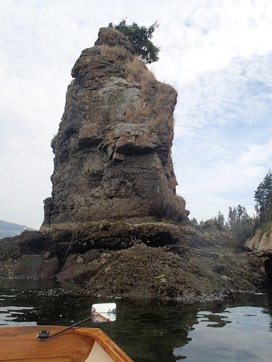
Siwash Rock is located on the West side of Stanley Park Between Ferguson Point and Prospect Point. It is a Volcanic Dike eroded from softer sedimentary rock. I have circumnavigated Siwash Rock many times, both by oar and by sail.
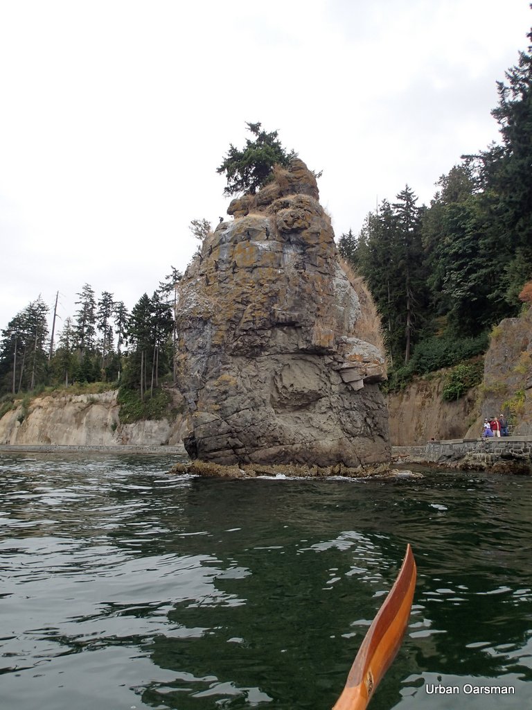
You need a high tide to do it. The rock is awash only at high tide. Here is a picture of the rock with about a nine foot tide:
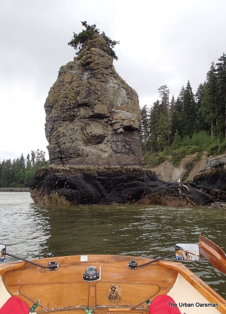
Siwash Rock, covered with mussels. It must have been a good spawning year in 2011.
I have rowed around her on a twelve foot tide to circumnavigate the rock.
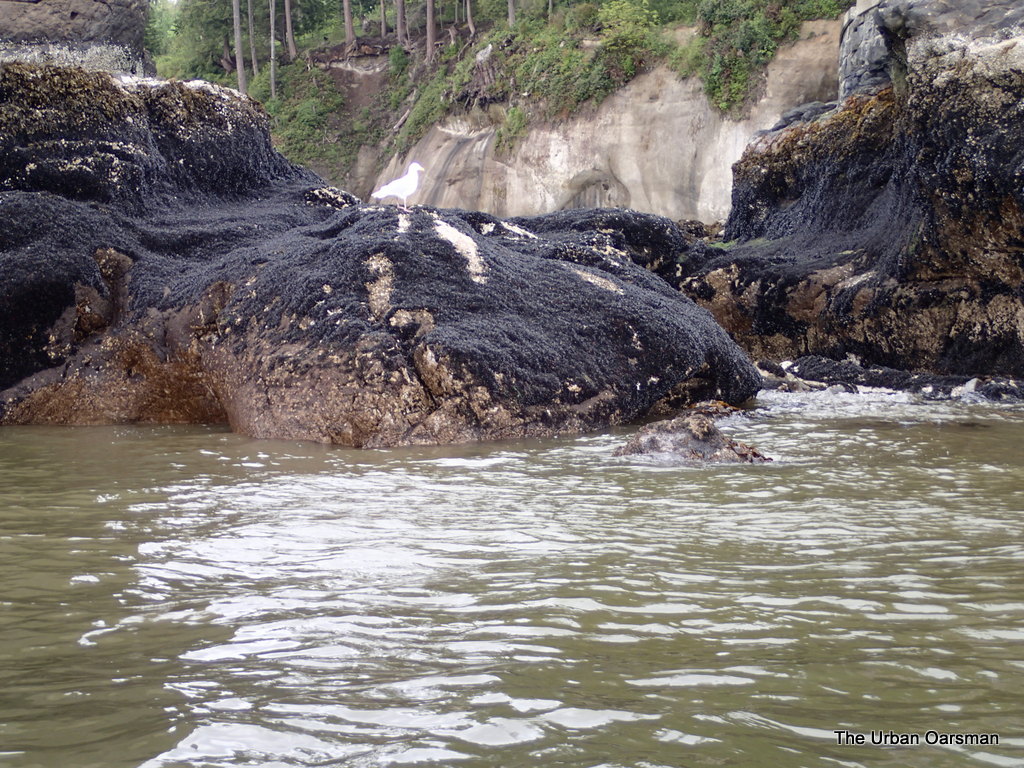
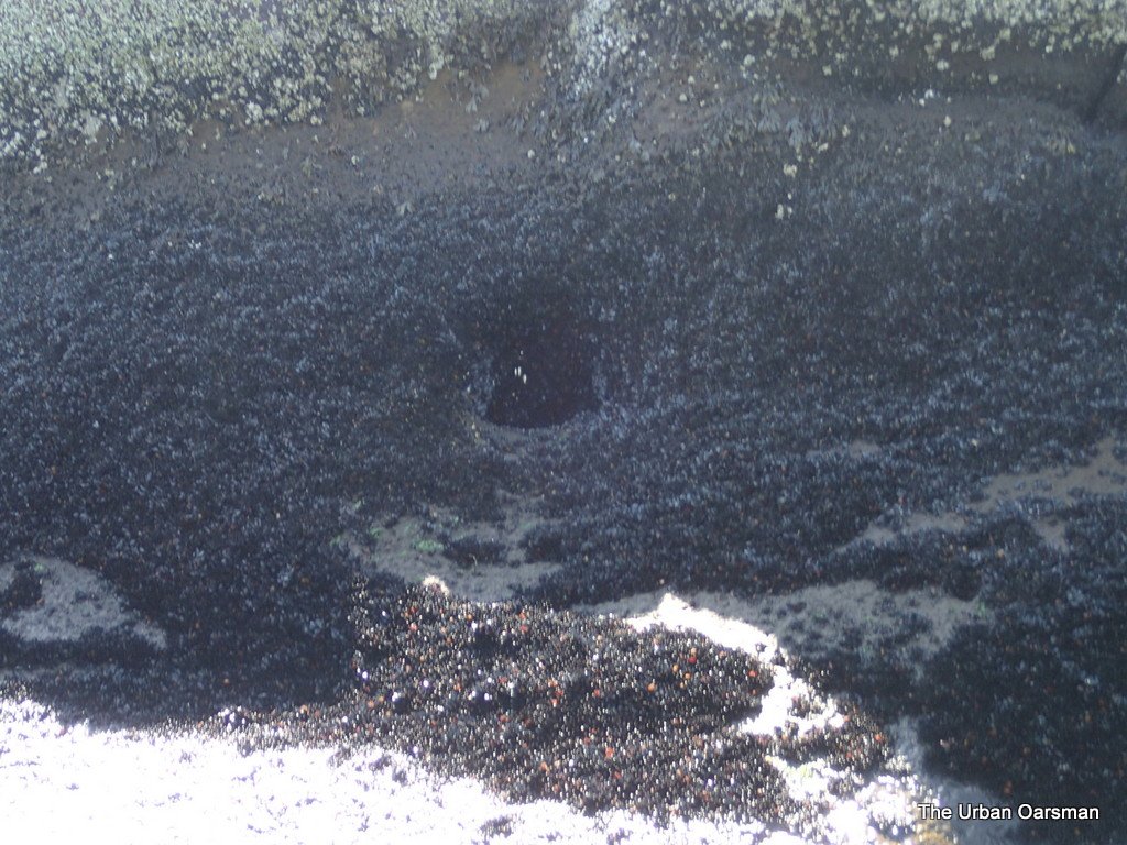
A close up of the gap to the right that you row over…..
Again, this is at about a nine foot tide. An twelve foot tide is enough enough water….for Gwragedd Annwn.
There are always a lot less people walking the Seawall in the winter.
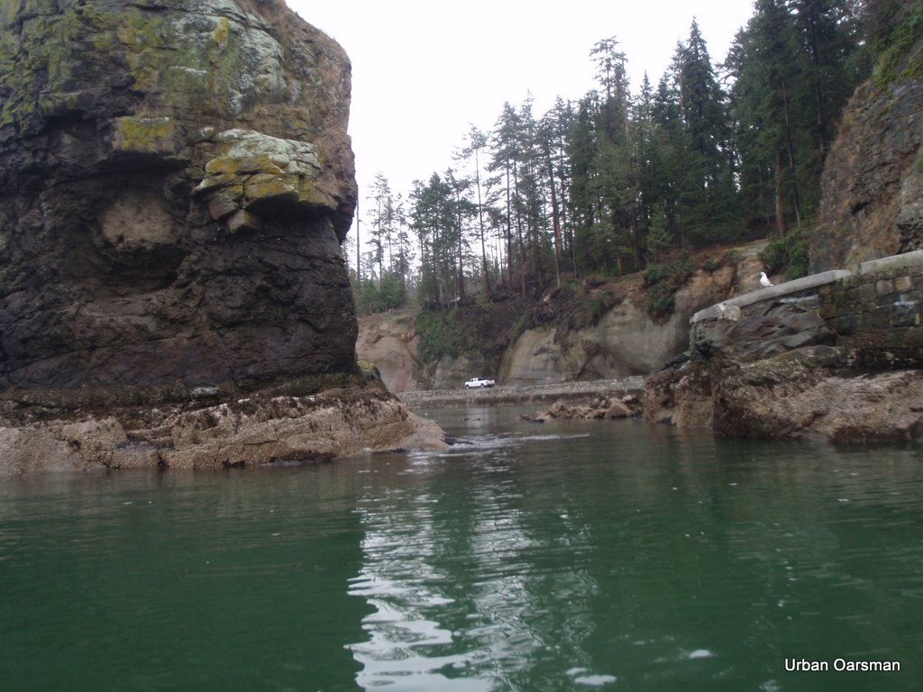
Another view of the gap, dry, at about a (according to the tide charts) nine foot tide:
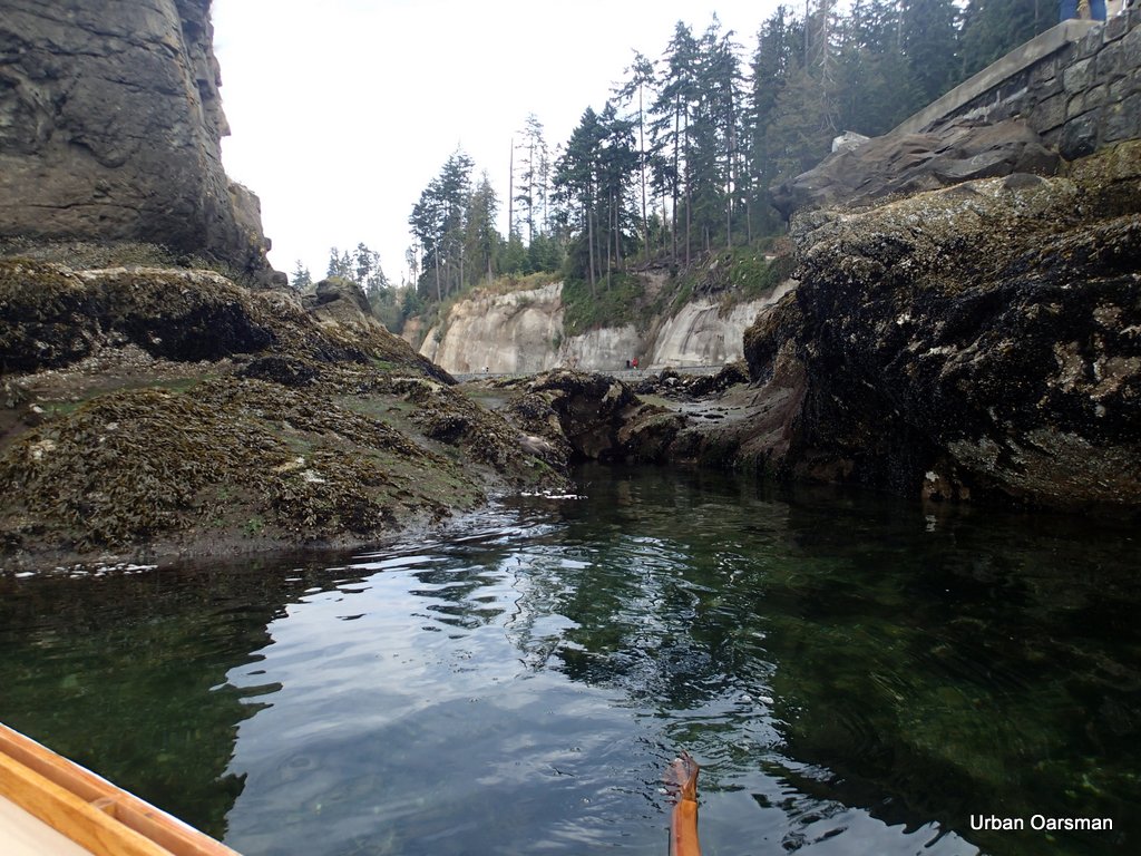
The Siwash Rock gap, dry, Looking East towards Stanley Park
Photo of Siwash Rock looking West, with a (according to the tide charts) twelve-six tide:

This photo was taken on September 9th, 2012 at 2:34pm. The tide table said that it was a 12.9′ Tide in Vancouver Harbour. From this experience, I would guess that I could circumnavigate with an 11′ tide, maybe a little less.
View from the West, with the same tide:
I have drifted through the gap on an incoming tide at just over a knot. I do not know how fast an the ebbing tide would carry Gwragedd Annwn and I through the gap.
.
Similar view of the rock, taken Two hours and forty-five minutes earlier, about a nine foot tide.
Urban Oarsman Matt, His son, and I rowed to False Creek, stopping to Circumnavigate Siwash along the Way:
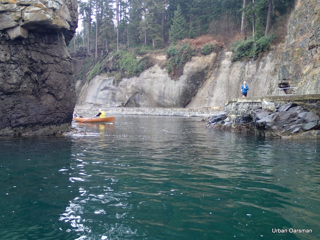
Urban Oarsman Matt & Son rowing around Siwash Rock, 11:53 am, February 3rd, 2013, with a (about) twelve foot-six tide. This is the first time Matt & Son had rowed around the rock.
.
This a picture of the gap taken on January 13th, 2009, at 2:14 pm at a fourteen-six (about) tide.
Notice how fewer mussels there are around the base of the rock compared to recent photographs.
This picture was taken after the big windstorm that blew down the trees in Stanley Park.
.
 One of the features that is not easily seen from the Seawall is the “sea-eye”. Is it a result of a lava tube when the volcanic dike was formed?
There is a secret treasure hole in the North-West corner of the Rock. It is not visible from the shore. It is awash on a fifteen-foot tide or so.
I am sure that all the Pirate treasure, Native artifacts or water-proof geocashes are in here. I have never rowed up to it and put my hand in to find out. Would be a great spot. Not many people know about this hole, but you do, because the Urban Oarsman knows of it, and you too. So on the next high tide, take a cruise around Siwash Rock. Look for your own treasure. You will be glad you did.
.
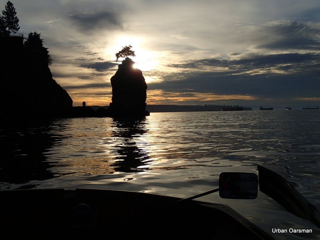
Siwash Rock at Sunset:
My goal this year is to get a photo of Siwash Rock with the setting moon.
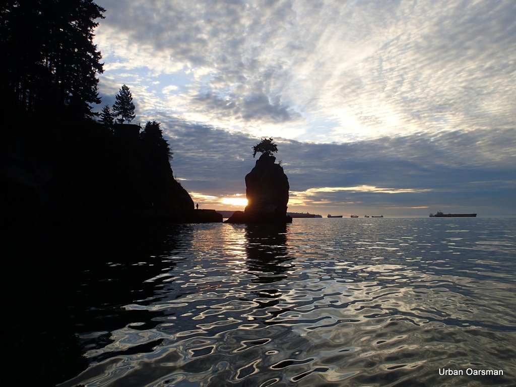
Another Row, Another Sunset.
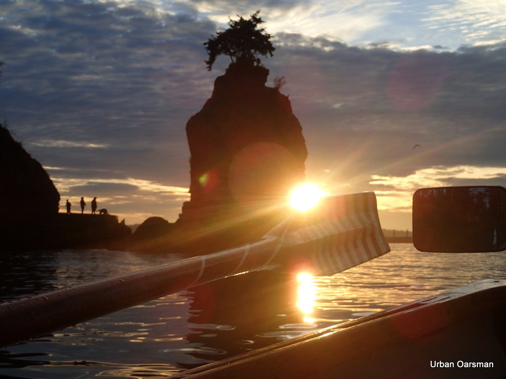
Siwash Rock, Depth-Sounder oars.
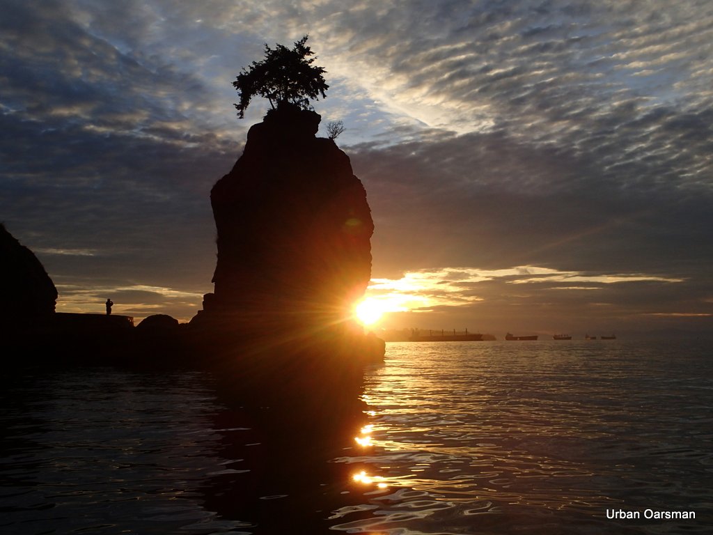
Same spot, no Depth-Sounder oars.
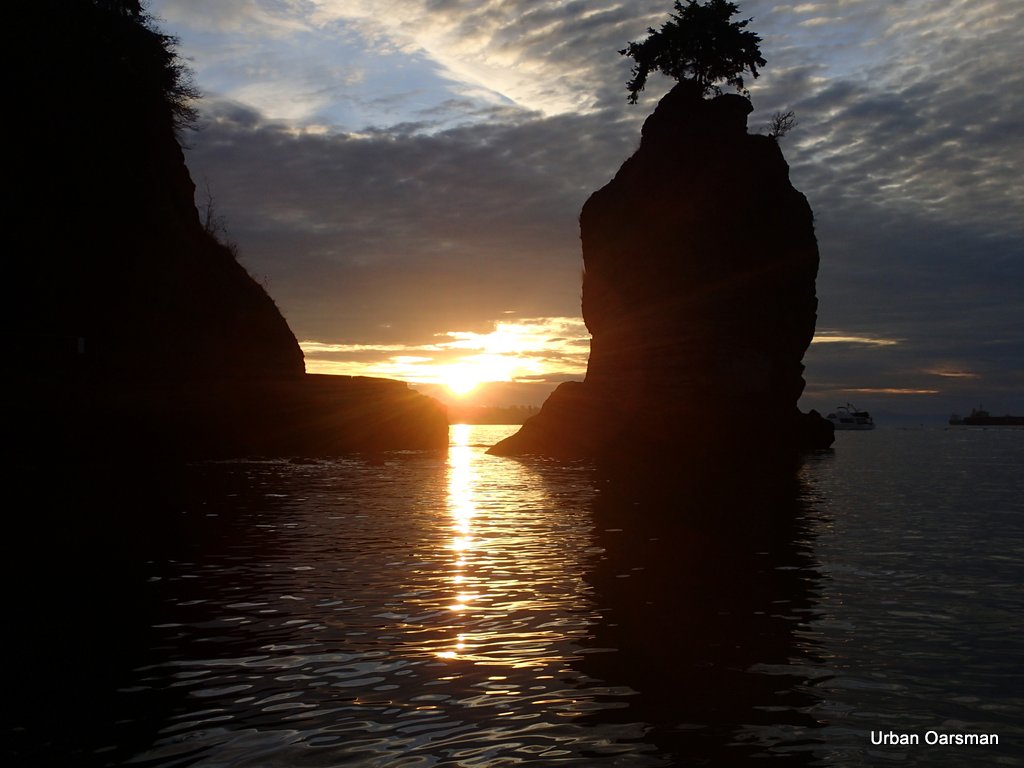
Same Spot, No Depth-Sounder Oars, no people on the Seawall.
Siwash Rock at sunset. a great place to be for the Urban Oarsman.
Mike
This entry was posted in
Under the Keel..... Bookmark the
permalink.

